If you are looking for Door County Maps, you’ve come to the right place. These maps of Door County can help you plan a beach outing, a trip to a lighthouse, or an excursion on the water.
Door County Lighthouses Map
This map is featured on our comprehensive post of Door County lighthouses.
Door County Beaches Map
This map is featured on our comprehensive post on Door County beaches. Use this map to find the perfect beach for a relaxing day along the shoreline.
Door County GIS Map
The Door County GIS Map has a wealth of data useful for many purposes. Use this maps to determine who owns various land parcels, to learn about the kind of land a parcel sits on, to find ATV routes and snowmobile trails, and more. If you need to find something in Door County, the GIS maps will have it.
Address and Parcel Locator
This address and parcel locator lets you find ownership information for land parcels in Door County. This information is also available on the Door County GIS Map, but it’s more user-friendly.
USGS Maps and Data
The U.S. Geological Survey makes a wealth of information available through several different means.
USGS Earth Explorer
This interactive map is a gateway to loads of information, including aerial and high-altitude photography, and more.
Door County Groundwater Contamination Susceptibility Map
The purity of groundwater has become a hot topic in the region. The U.S. Geological Survey has a series of maps that help to understand the susceptibility to groundwater contamination in Door County.
USGS Topographnical Maps of Door County
These PDF maps from the USGS show topographical data and more.
NOAA Nautical Charts
The waters around Door County can be quite treacherous, so information is your friend! These NOAA Nautical Charts, both electronic and PDF, can help you plan a safe and fun excursion
NOAA Electronic Nautical Chart
This electronic nautical chart from the NOAA can be viewed from standard web browsers.
NOAA PDF Nautical Charts
North End of Lake Michigan Including Green Bay
Historical Maps
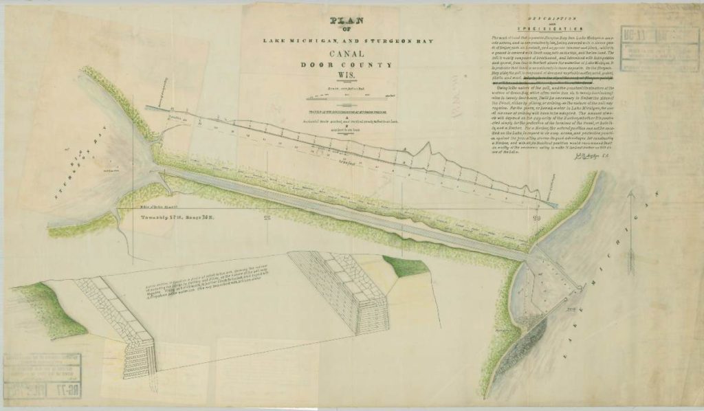
Plan of Lake Michigan and Sturgeon Bay Canal
This map is dated April 12, 1867. Obtained courtesy of the National Archives. Original file can be found by clicking here.
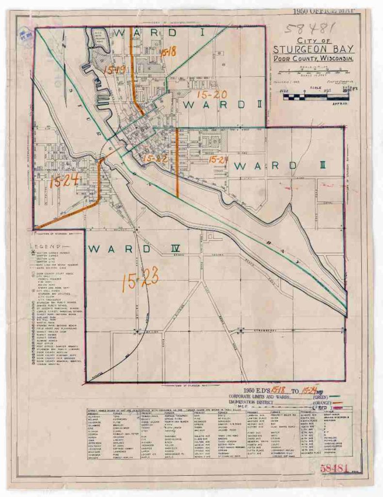
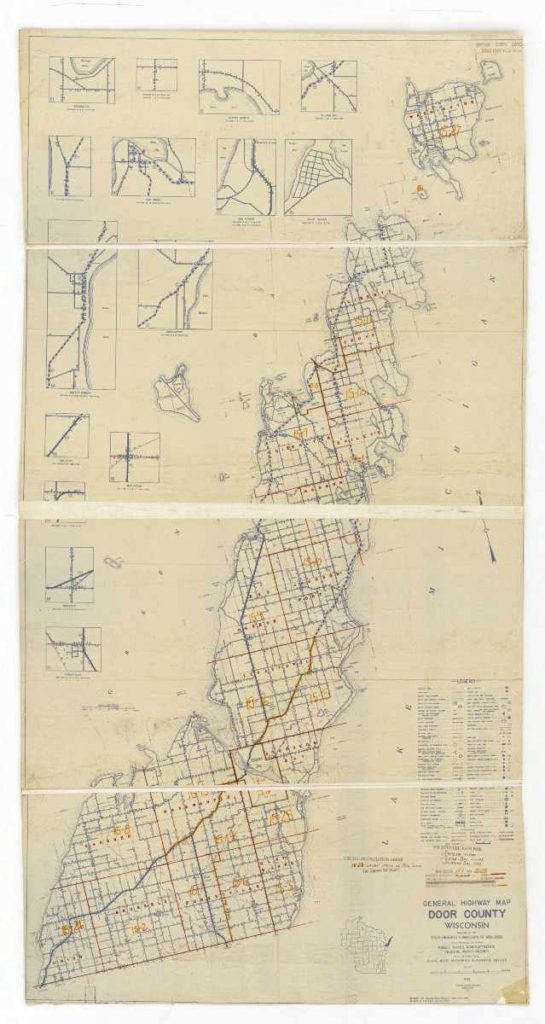
1950 Census Enumeration District Map of Door County
Obtained courtesy of the National Archives. The original file can be found by clicking here.
1950 Census Enumeration Map of Sturgeon Bay
Obtained courtesy of the National Archives. The original file can be found by clicking here.